|
|

|
I understand that the use of the maps below is for information purposes only. For official zoning, overlay district, height restrictions and Future Land Use designation please contact the planning office at (843)884-1229. For official flood zone information contact FEMA. |
|
Map showing the Zoning and Overlay District for each parcel |
|
Map showing the Comprehensive Plan Future Land Use for each parcel |
|
Map showing the maximum allowed height for each Parcel |
|
Map showing a representation of the 2004 FEMA Flood Maps |
|
Map showing Orthorectified Imagery from 2001 to 2019 |
|
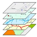
Map showing all available layers for advanced GIS users |
|
Map showing the trash collection day for each parcel |
|
Charleston County School District Interactive GIS Map |
- Zoning
- Land Use
- Height
- Flood Zone
- Imagery
- Advanced
|
|
 |
|||||
|---|---|---|---|---|---|
 |
|
||

 |
|
|||

|
||
|


|
|
|
|
|
|
|
|
